
PROGRAMMES: Transfrontier Conservation Areas
Usuthu-Tembe-Futi TFCA incorporating Usuthu Gorge
Contributed by Wisdom M D Dlamini, Swaziland TFCA Programme Manager, 2005
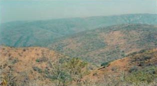
Covering an area of approximately 22958.39 acres (9290.97 hectares or 92.9 km2), this area lies in the Lubombo region, along the south of the Lubombo mountains and is bordered by the Greater Usuthu river in the South where it dissects the Ubombo mountain, thus the name "Usuthu Gorge". The core tourism area covers an area of approximately 5892.39 acres (2384.57 hectares or 23.85 km2). The Great Usutu River (Lusutfu) carves an impressive gorge through the Lubombo Mountains as it exits Swaziland. High cliffs adorned with cycads and abundant birdlife are features of this 8km long gorge, which is wild and uninhabited. Important wildlife species that have been spotted in this area include kudu, side-striped jackals, oribi and mountain reedbuck, among others. The river itself is Swaziland's largest watercourse and its waters are navigable by raft or canoe for most months of the year, although huge crocodiles are known to frequent the long pools between rapids. Sandy beaches occur at frequent intervals. The major vegetation types include mixed forests and woodlands, including bushveld. The Mowane gorge in this area is also a sacred site in Swazi culture.
- It supports the unique and most dramatic cliff face landscape of entire Lubombo Mountain range.
- Provides splendid extroversive visual qualities.
- Supports good communities of a variety of endangered species.
- Provides excellent cliff nesting and roosting facilities for rock loving birds especially birds of prey.
- Contains locality of several caves including Border Cave, of supreme archaeological significance (earliest known record of Homo Sapiens was found in this cave).
- Contains sites of historical and traditional significance, the Usuthu Gorge being the first historical and traditional route to the sea (~75km to/from the sea).
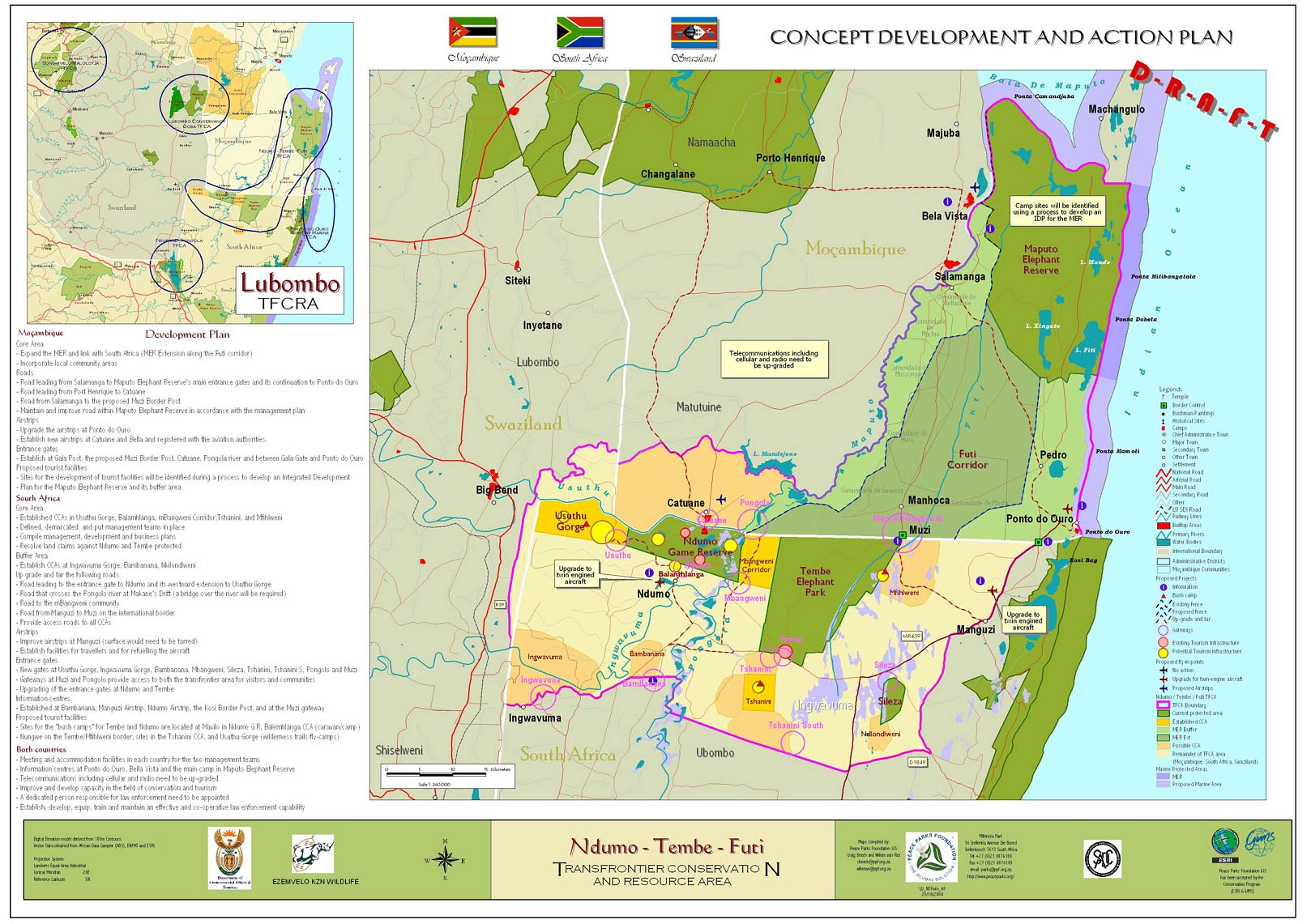
The Usuthu Gorge, apart from being a link for the Usuthu-Tembe-Futi Transfrontier Conservation Area (see Appendix 1) and the Lubombo Spatial Development Initiative, is in itself a fantastic area with wilderness qualities that are rare in Swaziland. The Lunkuntfu (Mambane) community, who live predominantly at the base of the Lubombo Mountains under the Nkilongo Inkhundla are well positioned to benefit from development in this area.
The Usuthu-Tembe-Futi TFCA links to the eastern end of this area. At its exit from Swaziland, the Ndumo-Tembe area is visible a few kilometres downstream and with the potential for border crossing formalities to be accommodated by the LSDI process, there exists a unique opportunity for water rafting, canoeing or walking trail linkages to this area, as well as Southern Mozambique. The area falls almost alongside the Manzini-Big Bend-Lavumisa road, which is a major tourism route through Swaziland.
As expected in a rural area such as this, there are few roads. In terms of community needs, all there is need for is infrastructure as relates to water, schools and health-care facilities. The main land uses are cattle rearing and arable farming, maize being the major crop, most of which is for subsistence consumption. Natural resources such as thatching grass and firewood could be availed on a limited basis to the community in specific areas.
Usuthu-Tembe-Futi TFCA reference documents:
Download Concept Development Plan (MS Word 386 Kb)
View Map (jpg 348 Kb)